Improving printing experience in OS Maps to leverage user satisfaction
Overview
We designed an improved printing experience when we learned that customers love offline experience more than it was known. It started with data analytics and interviews, to later get ourside and research user behaviour in the field. After gattering insights, we jumped to creating a solution that reflects more human-friendly experience in using digital and printed maps.
My Contribution
• Designing whole product improvement
• Conducting UX Research
• Organising Usability Testing
Key results
• 9/10 users
found it easier to use,
• 6/10 users
understood the benefit of the premium plan better
Platforms
Web
Year
2019
Problem
The core users of OS Maps were experienced country walkers. They love having an access to all maps in digital version. However, the best part of country walking was also disconnecting from digital world and switching to offline mode to enjoy the beuaty of the nature without buzzling and popping distractions. Paper maps are perceived as an atribute of adventure and freedom.
1. Bad printing output brings frustration
Customers often used printed maps for organising trips or special events. If map was not printed as expected, users were dissappointed.
Some of those customers were OS Champions. They were well known experts in cross walking and hiking world. They organisined events to encourage people getting outside and enjoying the scenery of all the natural beauty that Great Britain has. They were printing maps in bulk, so missed error resulted in wasted time and material.
2. People struggled with printing feature
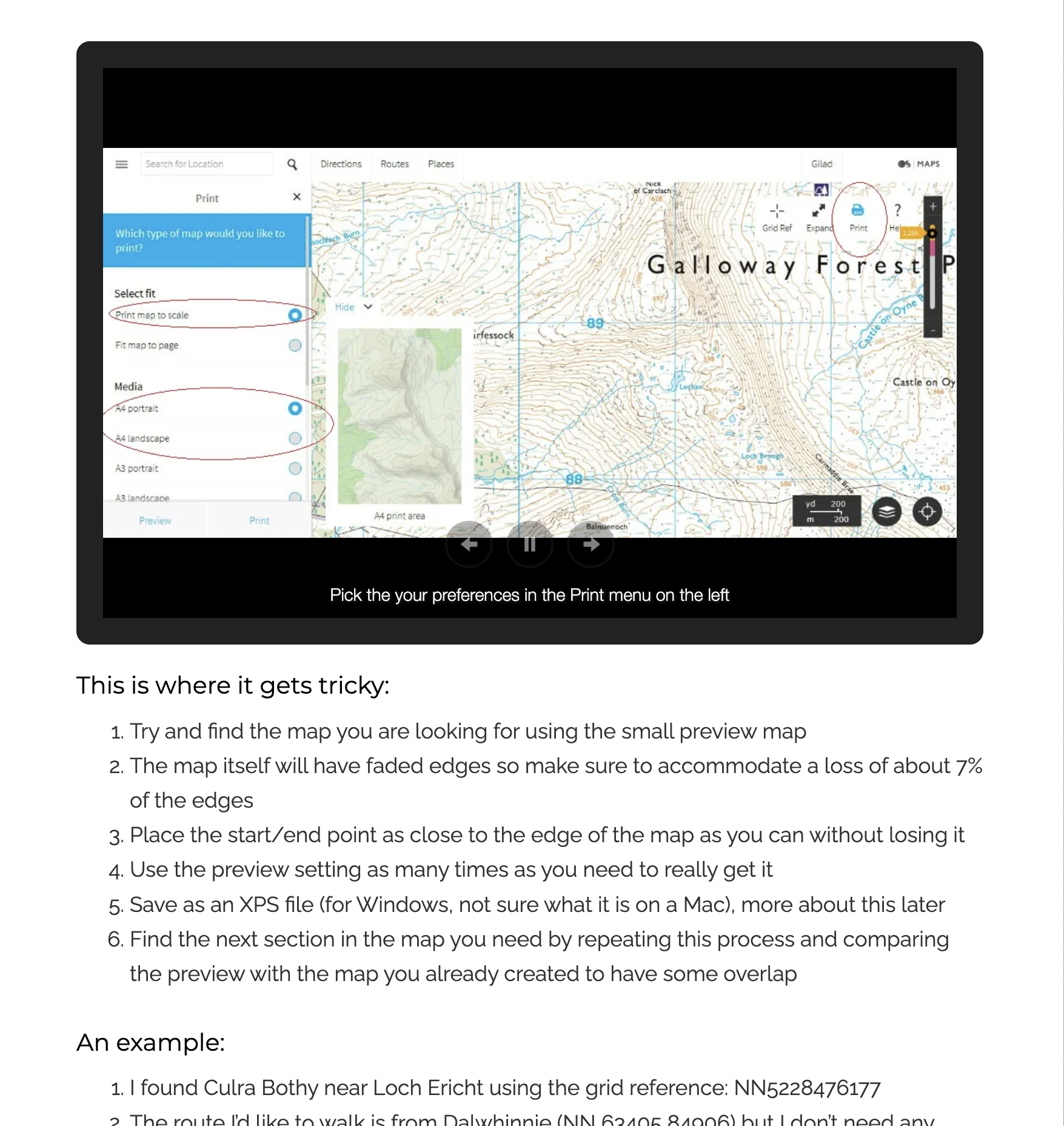
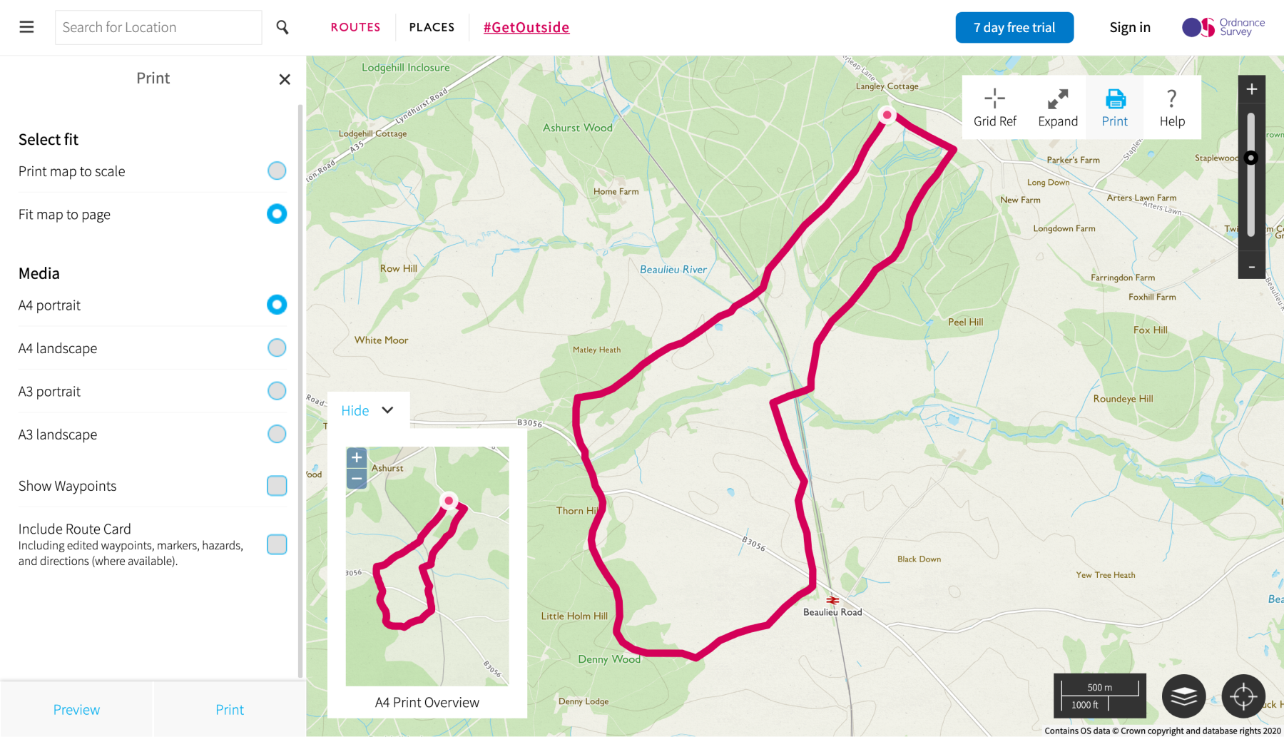
The printing feature was so bad that customers started doing their own tutorials. Additionaly, Preview showed different area than it was printed.
Source: outdoorsfather.com
3. Printing flow introduces unclear limitations
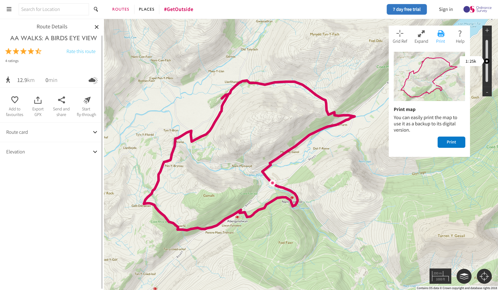
When opening printing mode, users had to focus on a tiny preview mode that showed slightly different view than the main view (and unnecessarly covered it.)
No more talking. Let's get into users' shoes. For real.
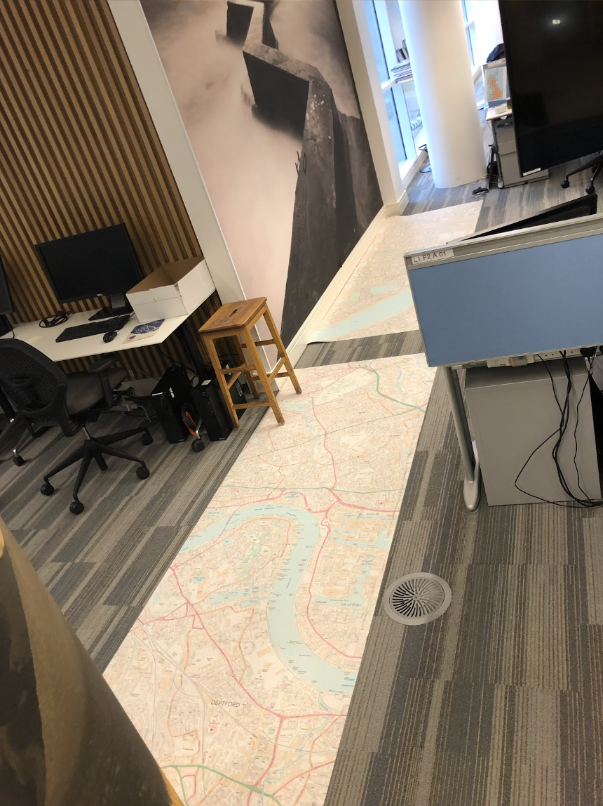
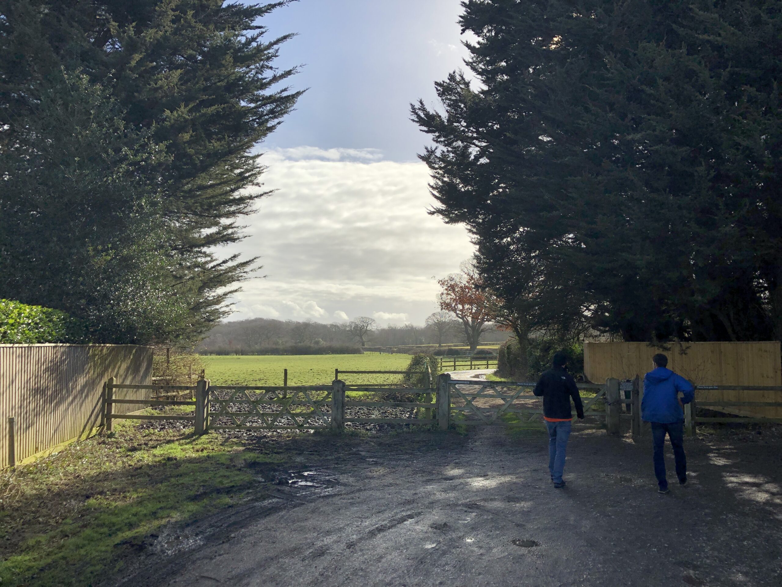
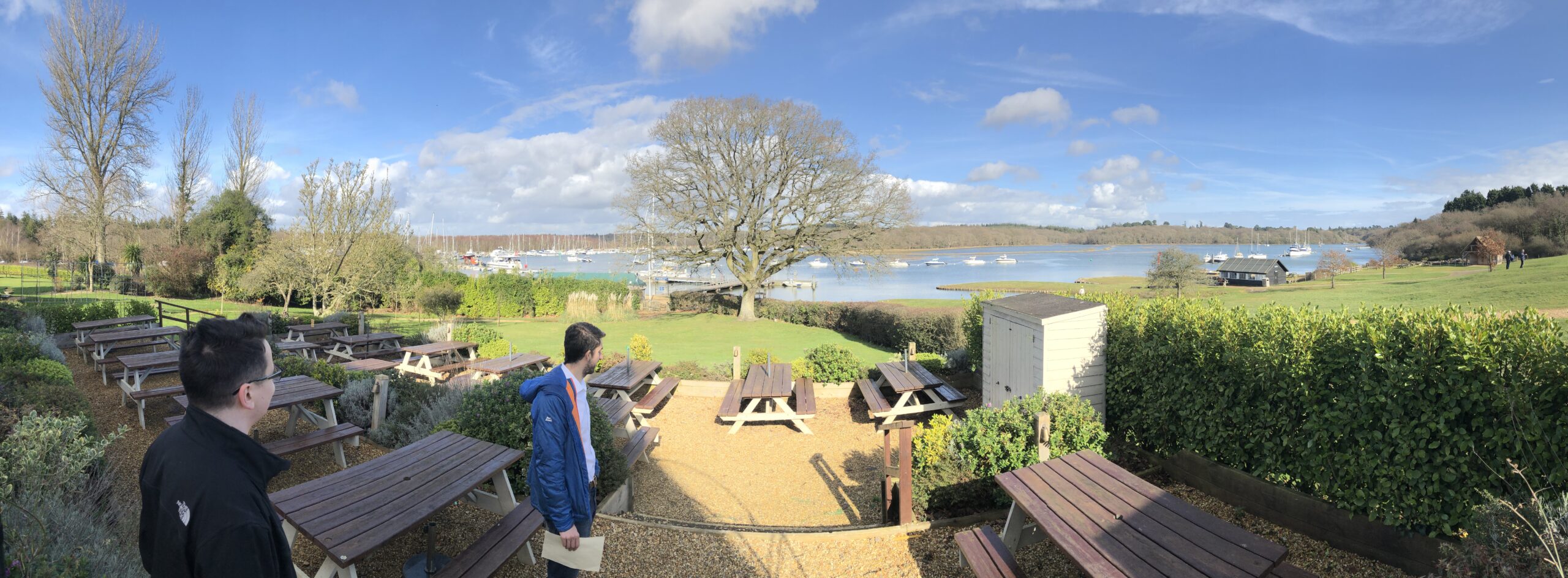
To learn how users interact with OS maps and paper maps, we decided to go for a trip and observe users in the field. It confirmed why paper maps are crucial for customers. From conversations, we learned that what they care the most is making map printing simple for everyone.

How might we make map printing simple and obvious?
Solution
The analysis of existing research and gathered input help me in teaming up with product manager, designers, and development team to crystalize the following design principles:

What I see is what I get
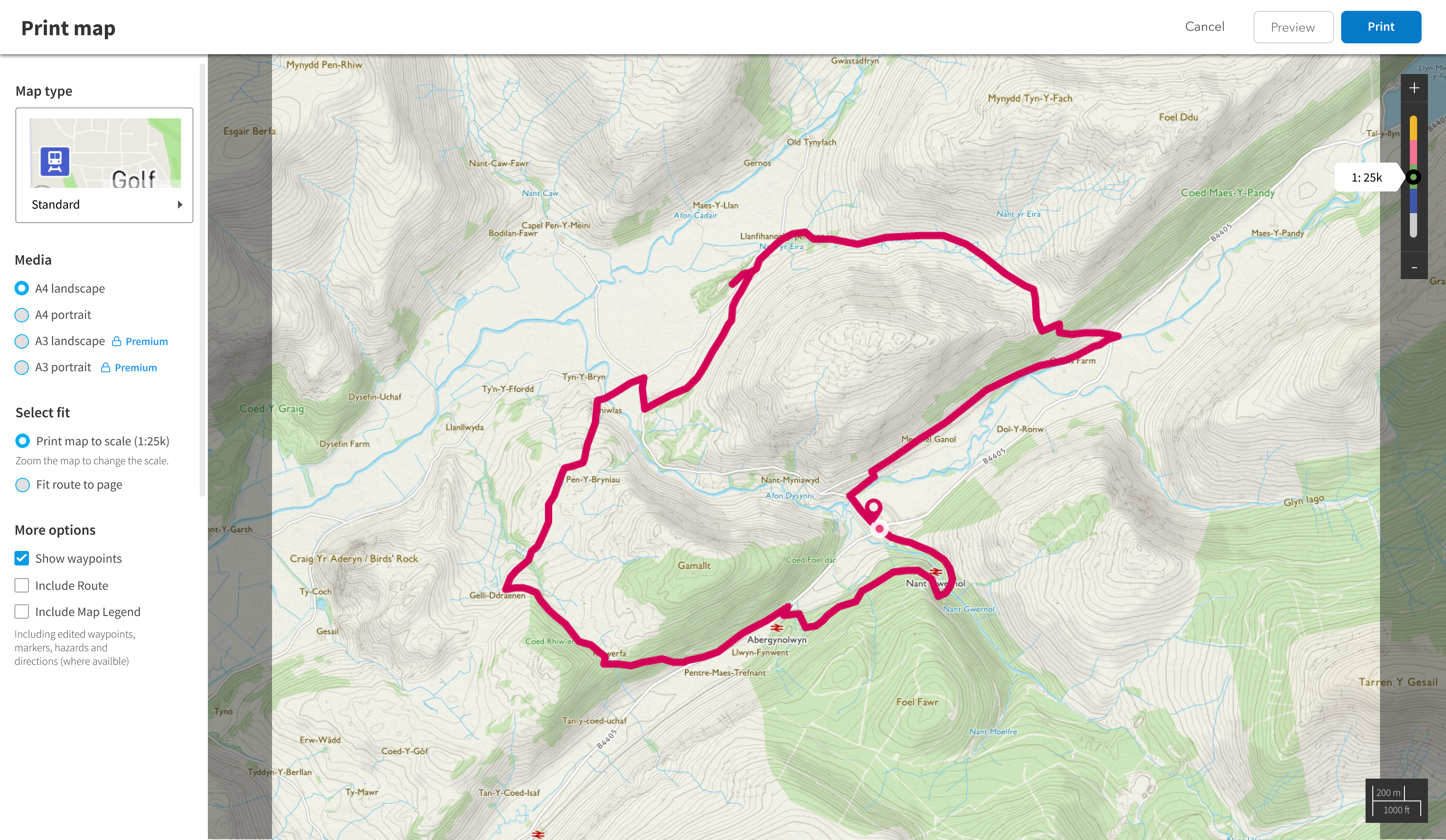
The past implementation showed the preview of the printed map that was misaligned with what users were getting at the end.
Adjust the map anytime
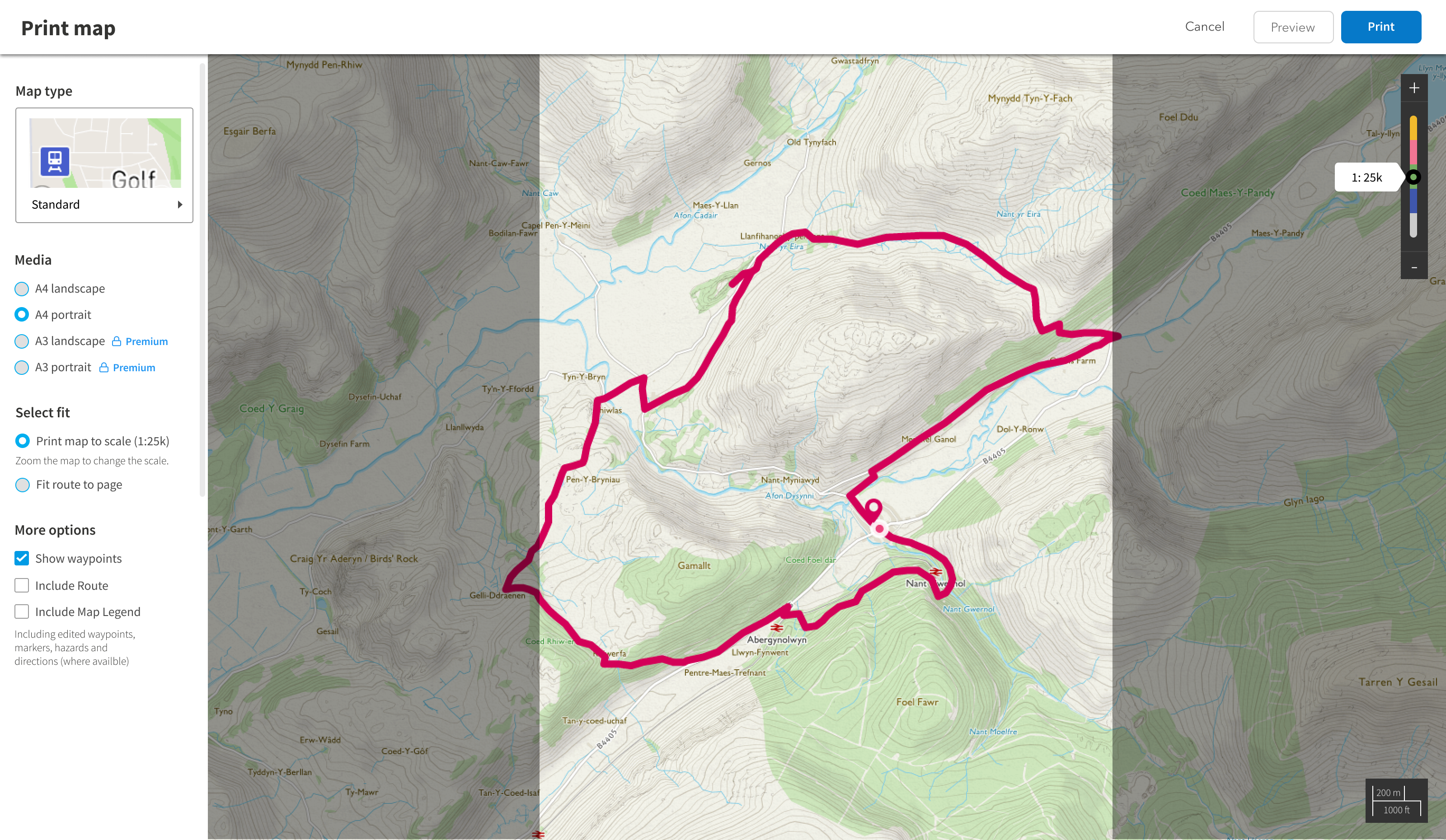
During interviews users often mentioned that they were not sure which map type they should use when printing for a selected scale. Data analytics confirmed high activity of switching maps before starting printing.
Show the premium benefits
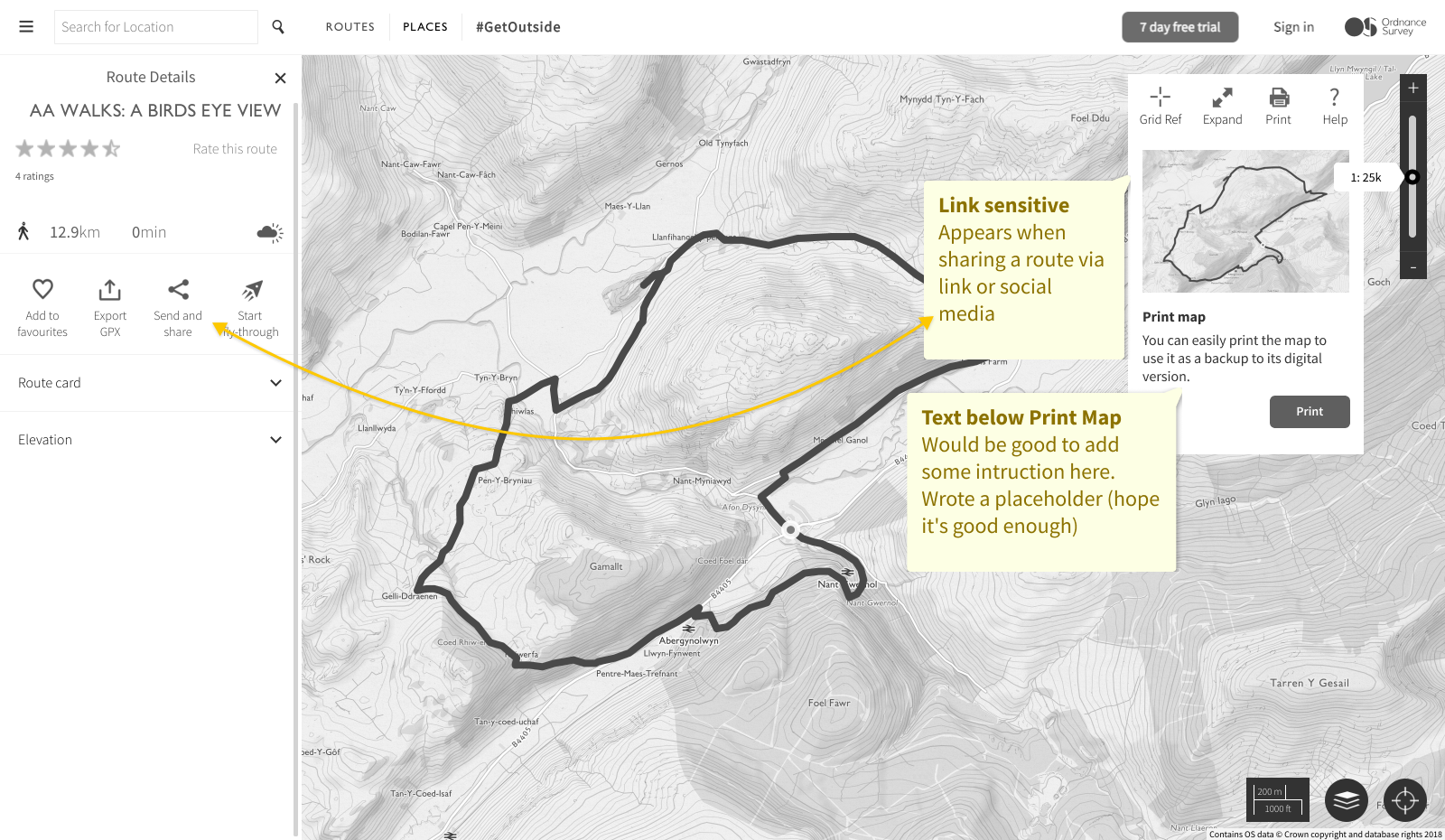
Users often faced paywall when opening premium features but it wasn't clear which are free and which not. We chose to empasize premium account display and reduce the experience friction by giving this infromation upfront.
Design
Find, share, print
When finding a nice route to visit, new users often didn't consider printing the map. It was an official Ordnance Survey reccomandation to their users: "when you go for a trip, always take a paper map". That's why decided to guide user who finds a route and wants to share it, that they also can print the map.
Present me options I can use
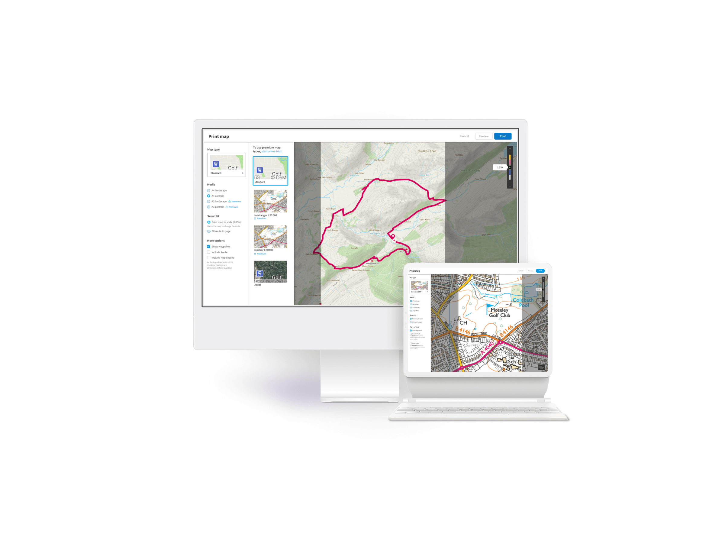
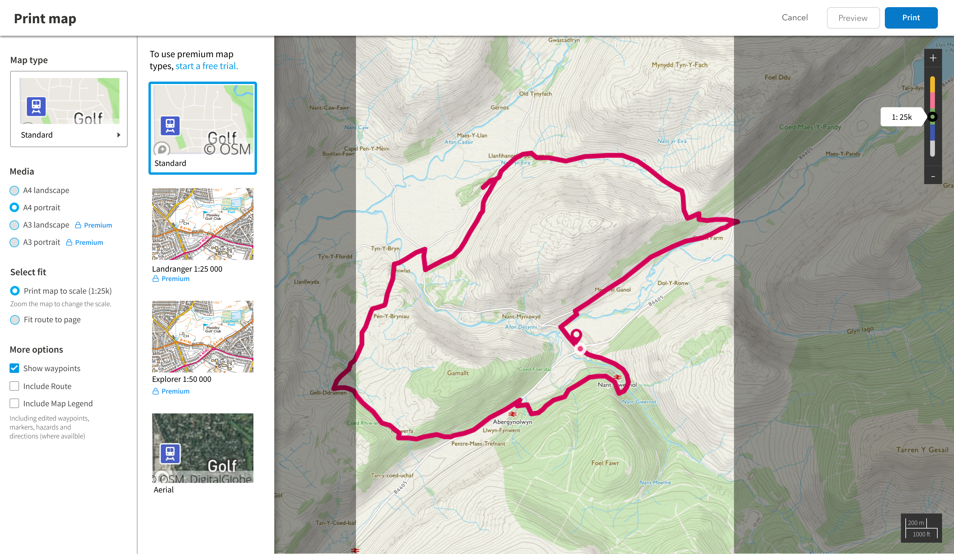
OS Maps struggled with presenting which maps are available for guest users and which are for paying customers. In a new solution, users could select the type of the map and paper size of the print. Additionally, they could see what features are available for them (at the moment, selecting premium features opened paywall that OS Maps had to keep.)
Results
We did a usabilty session with invited customers. From the sessions we learned that new feature was a good improvement and printing should be also a key part of creating a trip routes. This lead us to the next step, when I worked on recording user trips to share them as routes in the community.
Key Improvements
9/10
6/10
Users found new printing feature much easier to use
Participants confirmed they better understand the benefits for premium users
Comparaison Before-After

My work
Contact
Krystian Polański
krystian.polanski.design@gmail.com
© Krystian Polanski 2023
